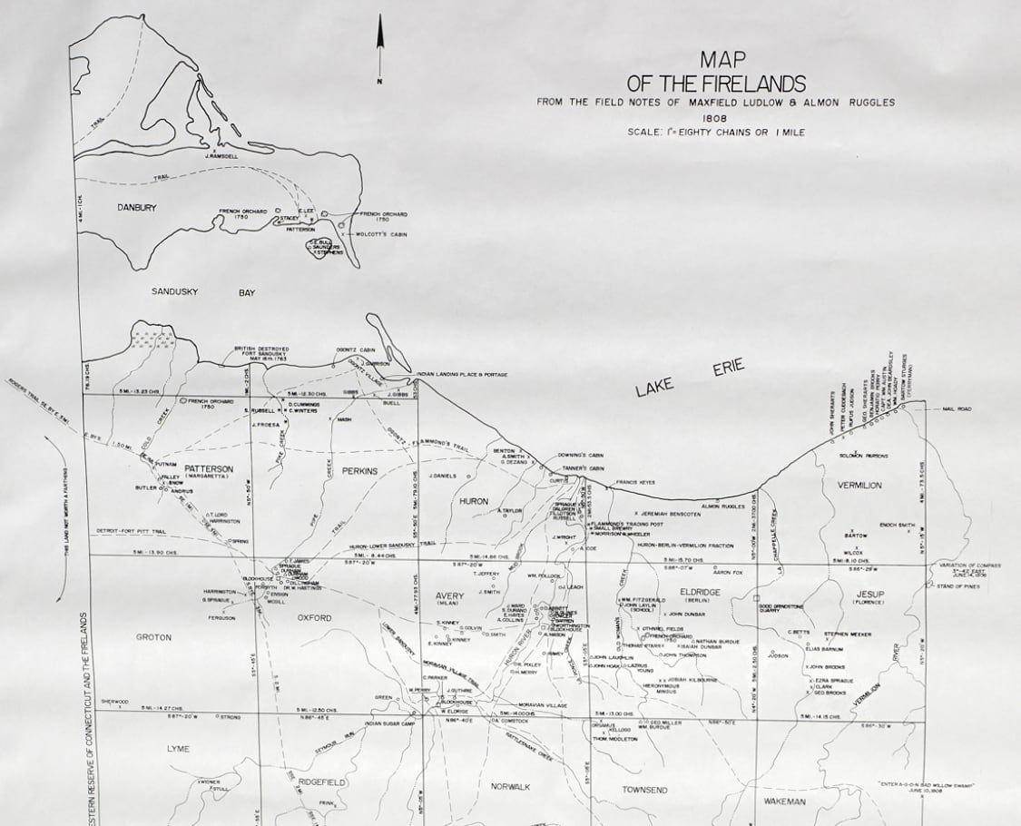
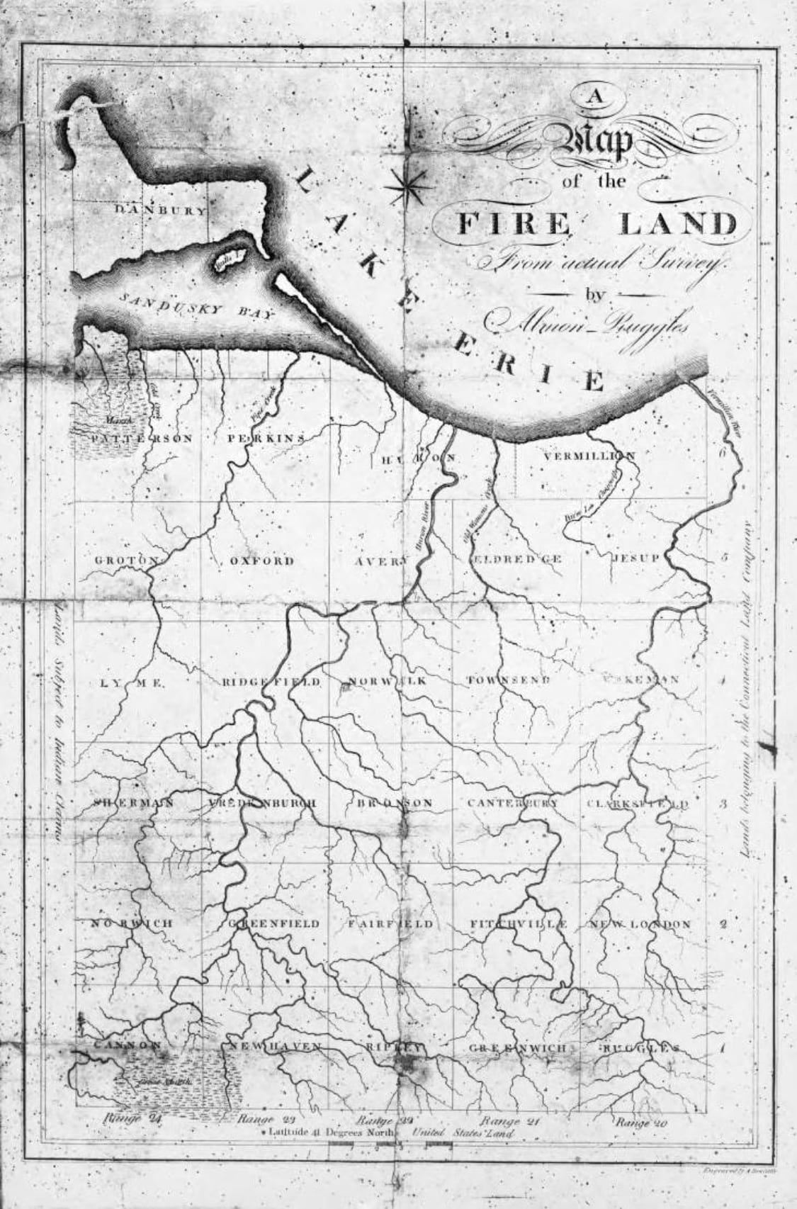
Skip Navigation
X iconBack

In 1792 the western section of New Connecticut, known as the Western Reserve, was granted by the state of Connecticut to 1,870 families living in the Connecticut towns of Greenwich, Fairfield, Danbury, Norwalk, New Haven, East Haven, New London, Groton and Ridgefield, whose homes had been burned by the British during the Revolutionary War.

The 500,000 acre tract of land, which was called the Firelands, encompassed the western most townships in the Western Reserve, including present day Erie and Huron Counties, and the eastern part of Danbury Township on the north side of Sandusky Bay in Ottawa County.

Many of the “fire sufferers” never emigrated to the Firelands. Many sold their land to speculators. One such man was William Winthrop of New York City who bought many of the sufferers’ claims. He hired Jabez Wright, an early settler of Huron and surveyor of the Firelands as his land agent.

Many of the first families who came to the Firelands traveled by covered wagons pulled by teams of oxen or horses. Others traveled to Buffalo, where they either followed along Lake Erie's sandy shore by wagon or loaded their possessions on small boats and journeyed by water.

Photo for The Firelands
The text at the bottom of the map reads: The Western Reserve is situated in the north east quarter of the state between Lake Erie on the north, Pennsylvania East. It extends 120 miles from East to West and upon an average, 52 from north to south. The area is just 3,000,000 of acres, a body of 500,00 acres is stricke[n] off from the west end of the tract and granted by the state of Connecticut as denation to certain sufferers of fire occasioned by the English during the Revolutionary War.
Photo for The Firelands
Map of the Firelands From the Field Notes of Maxfield Ludlow and Almon Ruggles 1808: Origin and Distribution of Settlers in the Firelands 1808-1814.
Photo for The Firelands
The Firelands was surveyed twice, once in 1806-07 and again in 1809 because of errors in the original survey. Almon Ruggles of Connecticut led both surveys. He settled Ruggles Beach in Berlin Township in 1810, where several of his descendants still live today.
Photo for The Firelands
This map was based on the survey of the Firelands by Almon Ruggles. It was published approximately 1809 by Amos Doolittle of New Haven, Connecticut.

My Bookmarks

CancelSend Email

Checkmark-in-circle icon
Activities Designed to Enhance Your Exploration

Select One:

You got

correct

Want another activity?

Back arrowBack to Topic Choices
Your program will now start over.
Bookmarks and activities will be reset.
I’m Not Done YetStart Over